


This site uses affiliate links for which we may be compensated
157989903186
Seller: barnhambooks
(2323)
100.0% positive
Bognor Regis, GB
IN_STOCK
:
Ends Jun 18, 2026 6:00:01 PM UTC
Category: Books, Comics & Magazines|Books
£225.00
Condition: Good
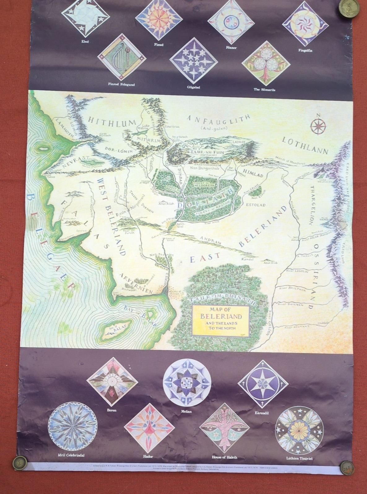
1978 Original Vintage J.R.R. Tolkien Map of Beleriand, Middle Earth Poster.
This is a 1978 map of J.R.R Tolkien's "Map of the Beleriand - and the lands to the North" from the fantasy world of Middle Earth. It shows the heraldry of 14 of the Eldar on the top and bottom of the map.
Printed in Great Britain by Henry Stone and Sons, Banbury, Oxfordshire.
1978 from George Allen & Unwin.
Dimensions: 30 in x 20 in (76cm x 51 cm).
Text reads: Emblems by J.R.R. Tolkien. Copyright George, Allen, & Unwin (Publishers) Ltd 1973 1978. Map drawn by Christopher Tolkien, coloured by H.R. Riddett. C George, Allen, & Unwin (Publishers) Ltd 1977 1978. Printed in Great Britain by Henry Stone & Sons (Printers) Ltd Banbury.
Condition: There are small tears around the edges, as well as crinkles, scratches, and folds, and small bits missing.There are blue tack residues visible on the front and back of the poster and there are stickers and reinforcements and their residues on the reverse. The poster has been stored rolled.
Please see the photos for details of the condition.
Any questions, please ask.
A fabulous opportunity to acquire this rare 1978 Tolkien poster - a must-have for fans of The Middle Earth stories.
Thanks for looking.


 42
42