Tolkien Collector's Guide
Sign In
Tolkien Collector's Guide
Important links:

Guide to Tolkien's Letters
-
Winner of the 2019 Tolkien Society award for Best Website

12

Middle-earth maps in LOTR translations

17 Jan, 2023
2023-1-17 6:35:32 PM UTC

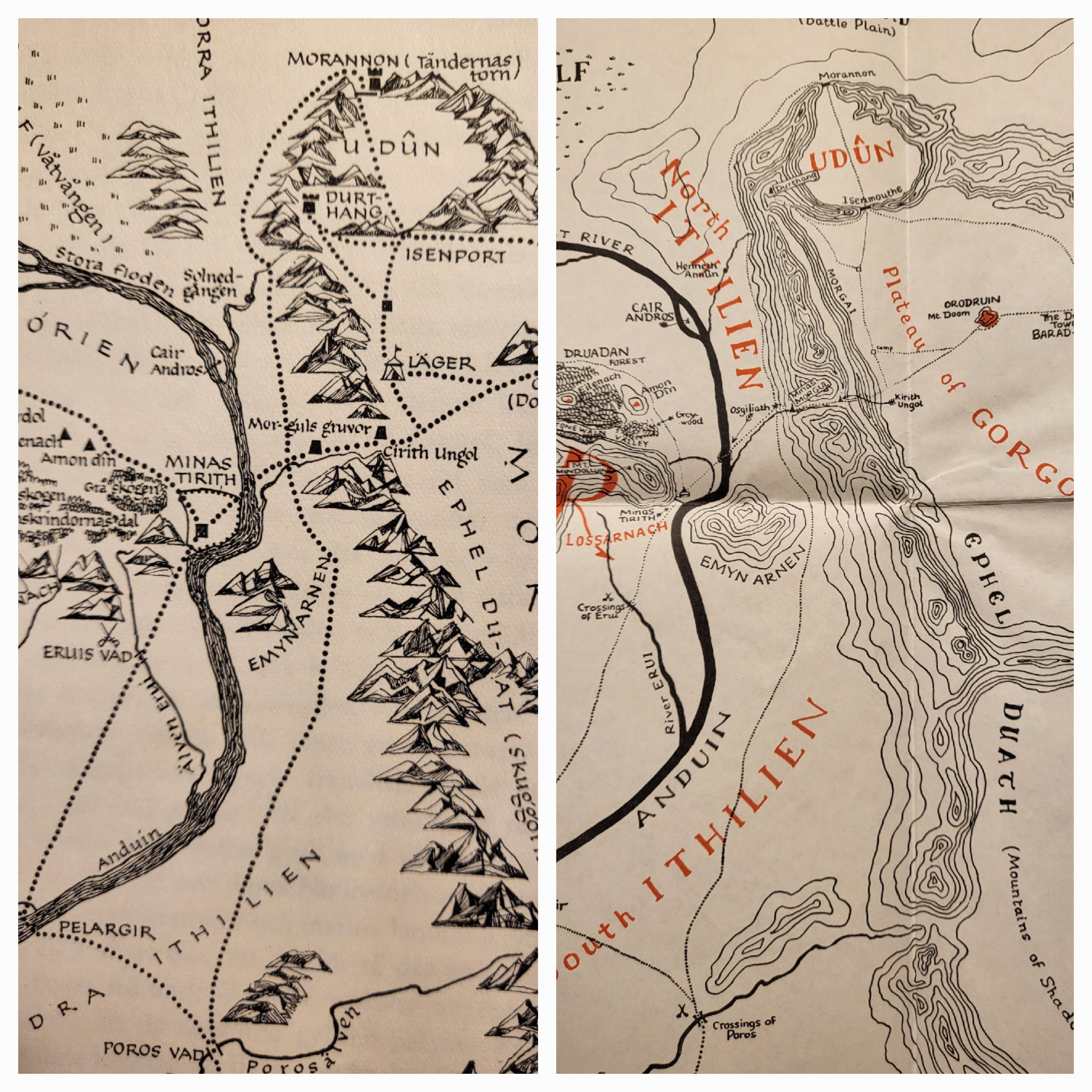
I was intrigued to see that the first translations of LOTR into Swedish (1959-61) included maps which were distinctly different from those drawn by Christopher Tolkien. As you can see, there is a notable difference in style (extracts from the large scale map from ROTK).

I wonder what the reasons were for this. Perhaps there were (technical) difficulties in constructing a copy adequate for the local printers. Perhaps the original (large, fold-out) maps were not easily reducible to the size required. Perhaps the publisher thought it could be improved upon!

I think I recall seeing that map reproductions (i.e. of the original) enter into the Swedish editions from the 1980s onwards (I don't have any so can't check!) - using the map redrawn for Unfinished Tales.

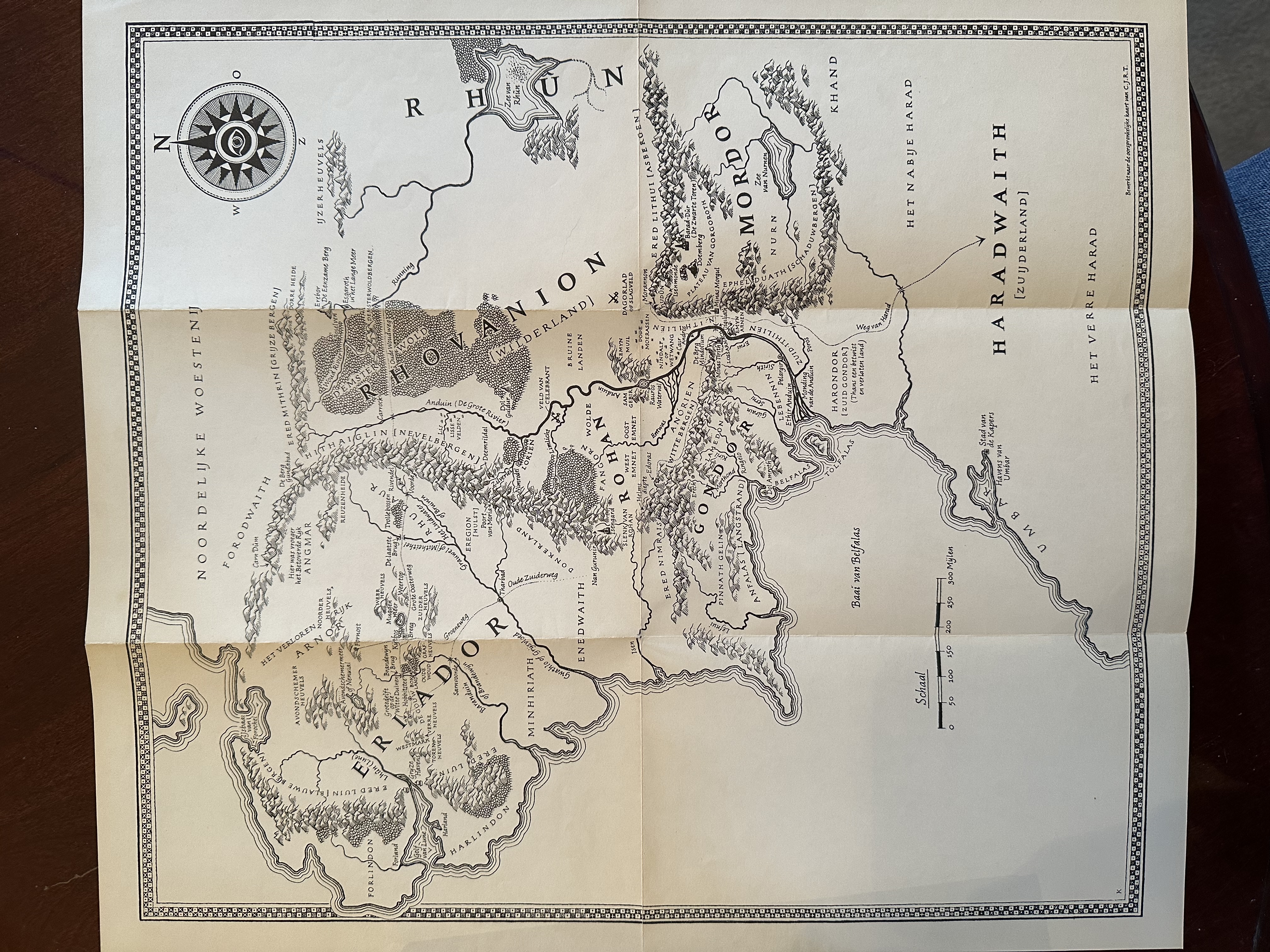
I've also seen online that the first Dutch translations (which pre-date the Swedish) included maps much closer to Christopher Tolkien's style, but still not reproductions.

In any event, what particularly interests me is how common this practice was in other translations, and if it continues to this day?

Any insights here would be gratefully received!
5570_63c6e9b45c067.jpg 2880X2880 px
17 Jan, 2023
2023-1-17 7:20:09 PM UTC
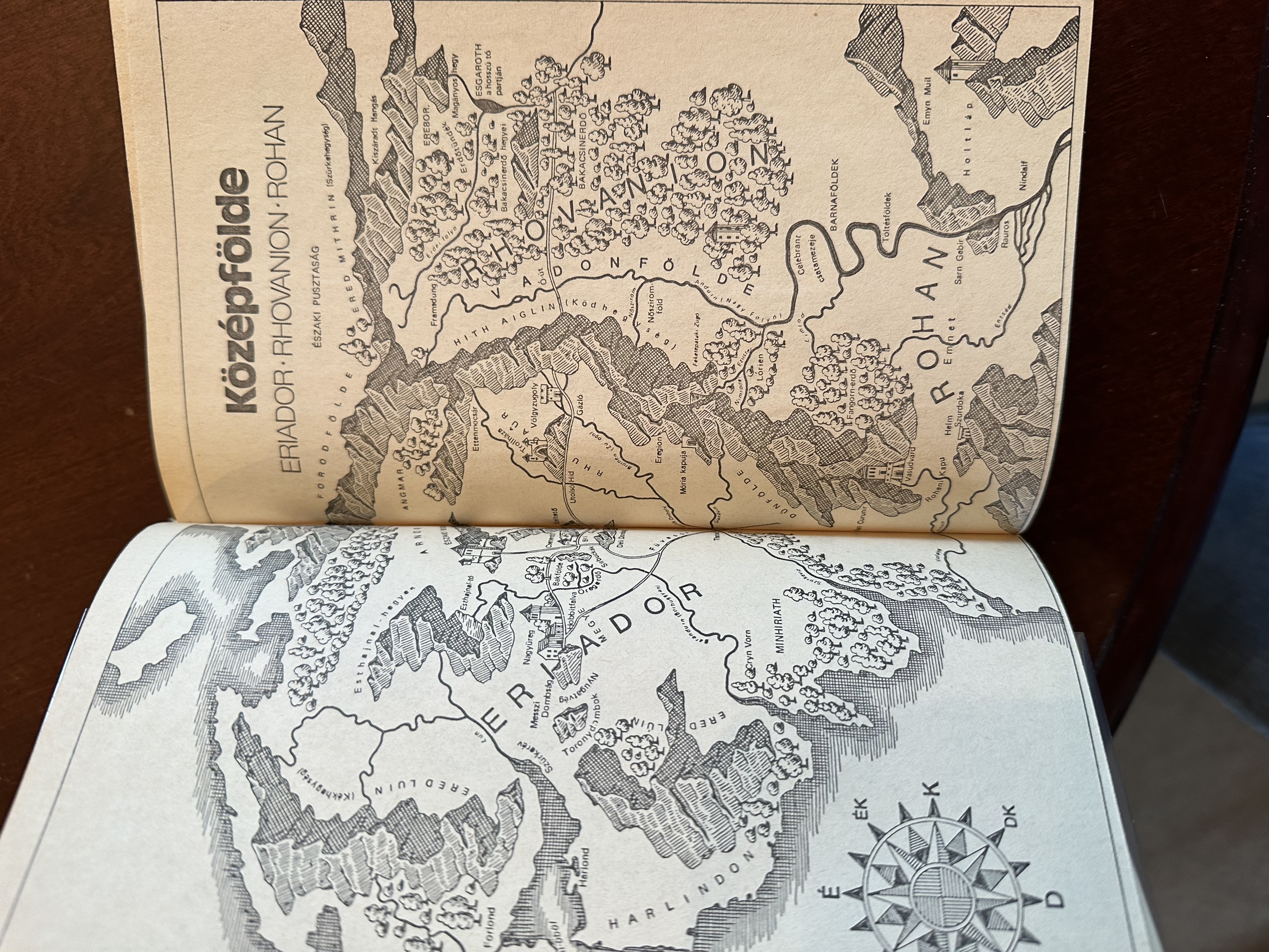
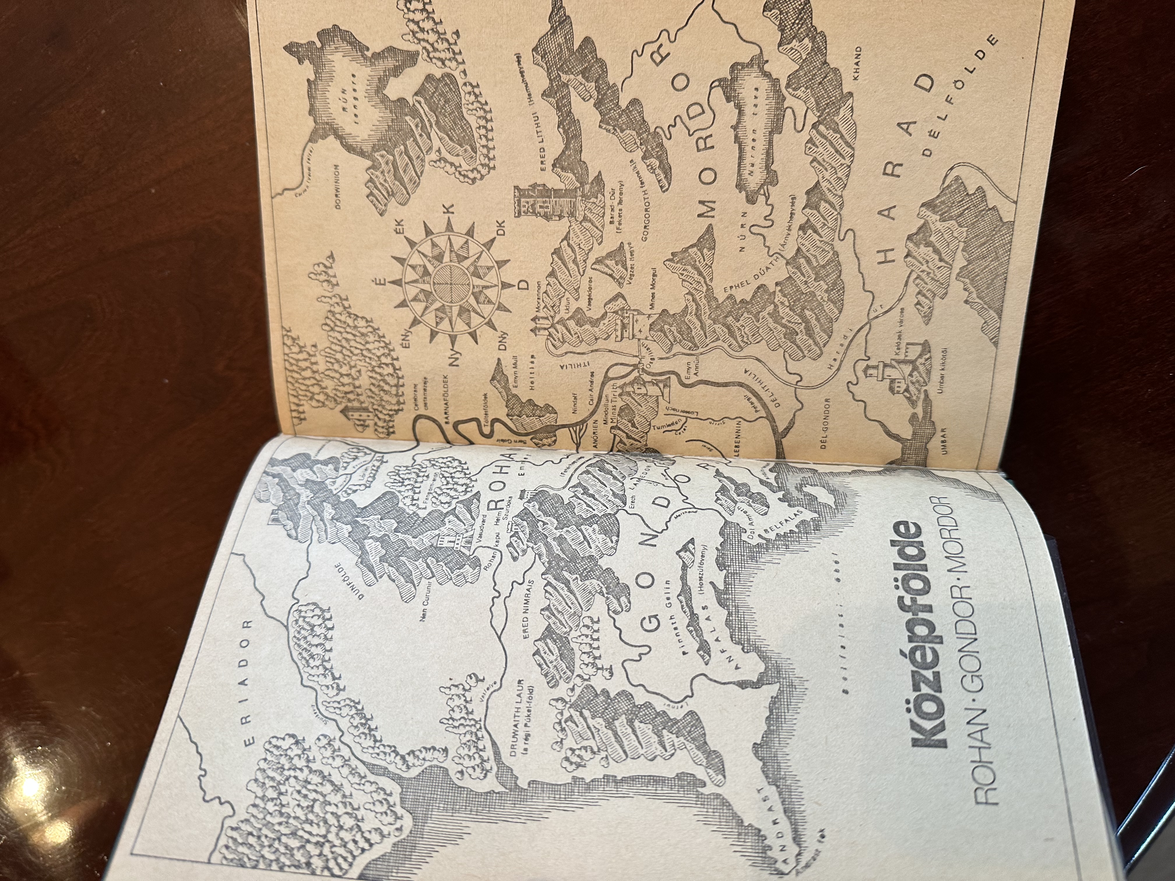
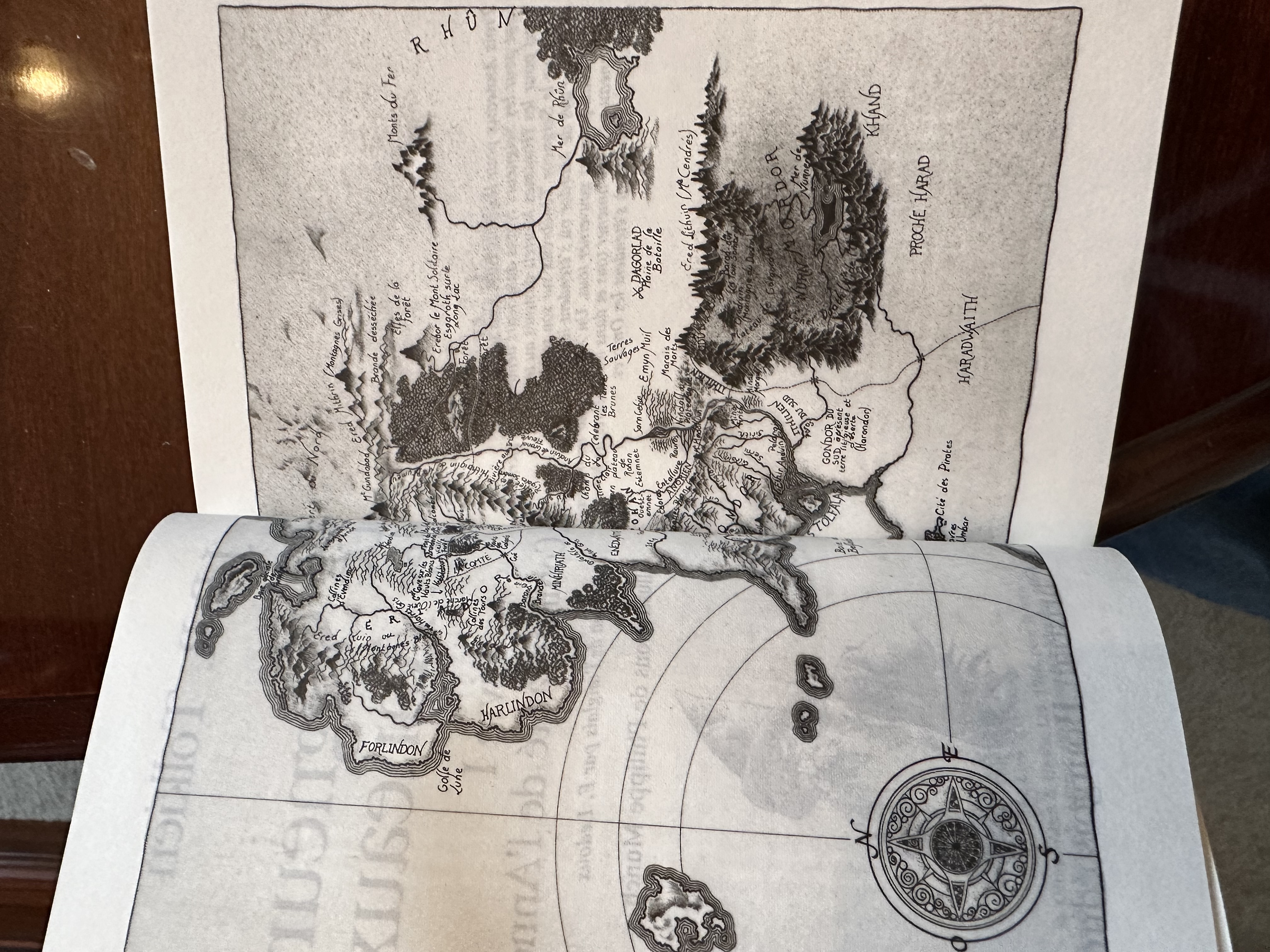
Here are the redrawn maps from my 1981 Hungarian LOTR translation and 1988 French:

5090_63c6f4c856901.jpeg 4032X3024 px

5090_63c6f4c858326.jpeg 4032X3024 px

5090_63c6f5f529730.jpeg 4032X3024 px
17 Jan, 2023
2023-1-17 7:30:49 PM UTC
I wonder if maps were purposely redrawn to match the artistic style required or for readability purposes, especially in smaller format editions (like paperbacks)?
17 Jan, 2023
2023-1-17 7:39:46 PM UTC

LanceFormation wrote:

I wonder if maps were purposely redrawn to match the artistic style required or for readability purposes, especially in smaller format editions (like paperbacks)?

These are interesting, LanceFormation can you post images of the Dutch maps too just for comparison? I would, but I am not at home to dig mine out.
17 Jan, 2023
2023-1-17 8:00:31 PM UTC

Mr. Underhill wrote:

LanceFormation wrote:

I wonder if maps were purposely redrawn to match the artistic style required or for readability purposes, especially in smaller format editions (like paperbacks)?

These are interesting, LanceFormation can you post images of the Dutch maps too just for comparison? I would, but I am not at home to dig mine out.

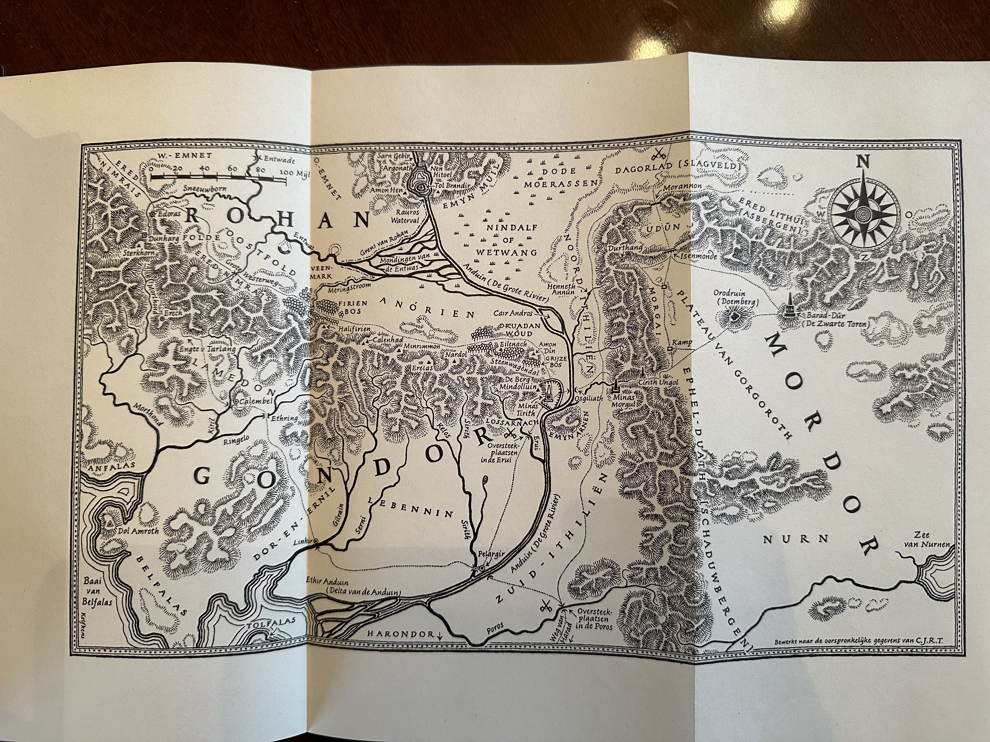
Here you go, 1957 Dutch:

5090_63c6fe57898dc.jpeg 4032X3024 px

5090_63c6fe578b56c.jpeg 4032X3024 px
17 Jan, 2023
2023-1-17 8:07:32 PM UTC
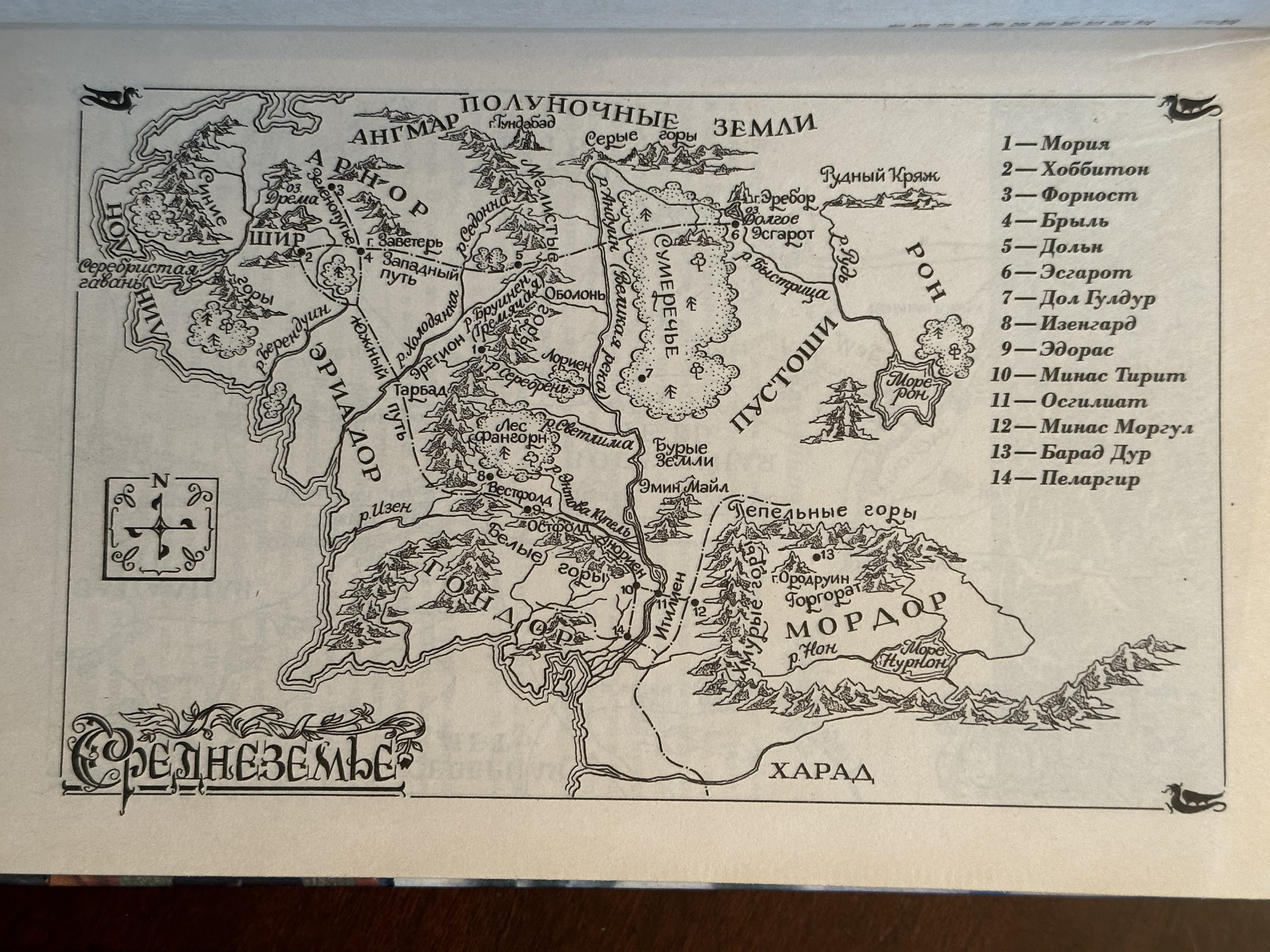
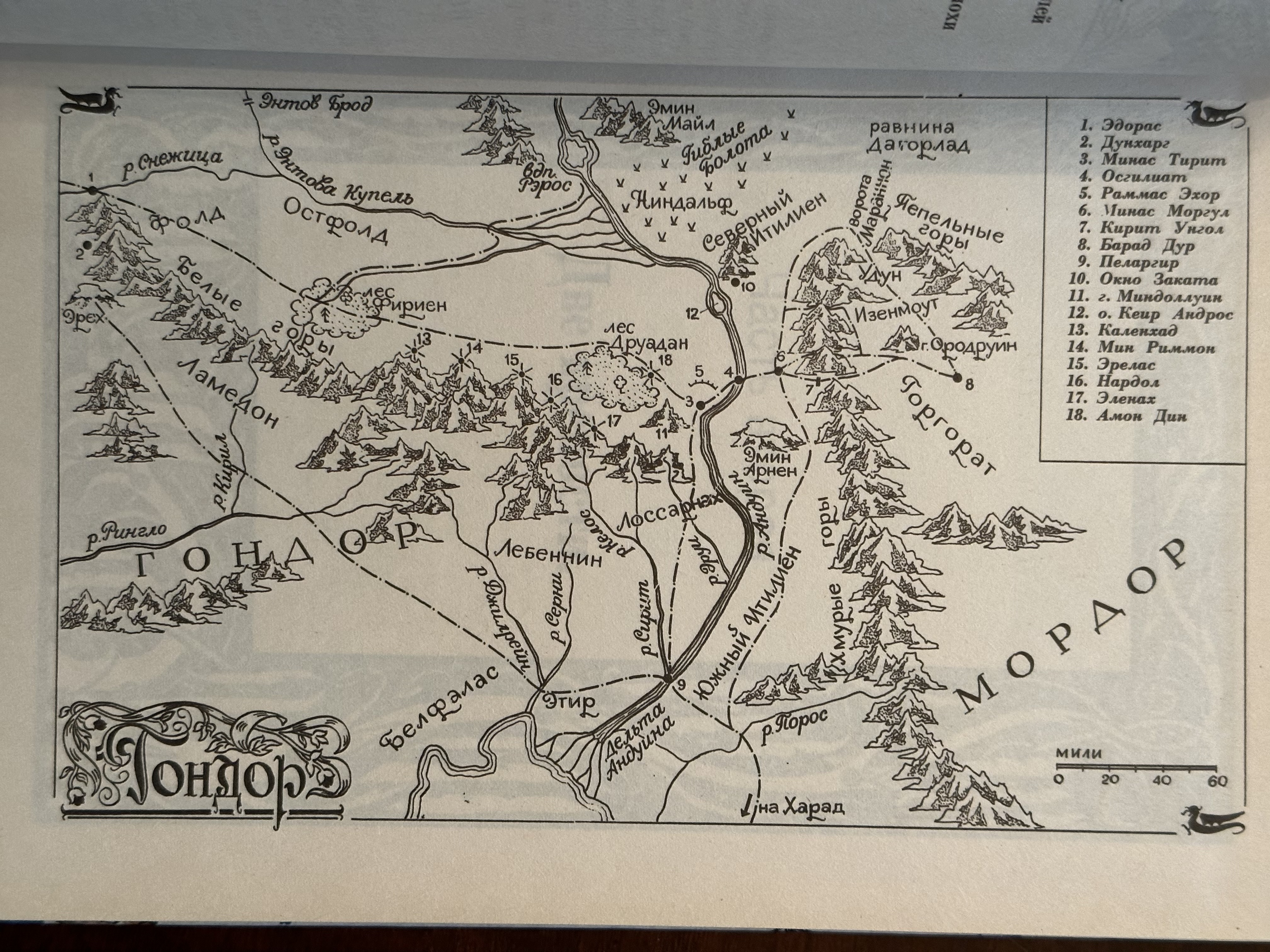
And maps from my 1994 Russian translation:

5090_63c6ffffc3f8a.jpeg 4032X3024 px

5090_63c6ffffc57d8.jpeg 4032X3024 px
17 Jan, 2023
2023-1-17 8:13:52 PM UTC

LanceFormation wrote:

Mr. Underhill wrote:

LanceFormation wrote:

I wonder if maps were purposely redrawn to match the artistic style required or for readability purposes, especially in smaller format editions (like paperbacks)?

These are interesting, LanceFormation can you post images of the Dutch maps too just for comparison? I would, but I am not at home to dig mine out.

Here you go, 1957 Dutch:

These are really nice maps, very impressive.
17 Jan, 2023
2023-1-17 8:26:26 PM UTC
Thanks for sharing! Yes those Dutch ones have been really nicely done. The representation of mountains is quite reminiscent of those in John Thomson's Atlas of Scotland (1832) - here in case anyone is curious:

https://maps.nls.uk/atlas/thomson/index.html
17 Jan, 2023
2023-1-17 8:29:18 PM UTC

LanceFormation wrote:

I wonder if maps were purposely redrawn to match the artistic style required or for readability purposes, especially in smaller format editions (like paperbacks)?

The readability angle does seem very plausible.

It may be a wild goose chase but I'm tempted to see if the successor to AWG (the Swedish publisher) has any records that can be consulted.
17 Jan, 2023
2023-1-17 8:37:36 PM UTC

Predictable Matt wrote:

Thanks for sharing! Yes those Dutch ones have been really nicely done. The representation of mountains is quite reminiscent of those in John Thomson's Atlas of Scotland (1832) - here in case anyone is curious:

https://maps.nls.uk/atlas/thomson/index.html

Yes! I see the similarities.
12
Jump to Last
All original content ©2024 by the submitting authors. Terms of Use | Privacy Policy | Cookie Policy | Contact Us