1 Dec, 2016
2016-12-1 7:07:50 AM UTC
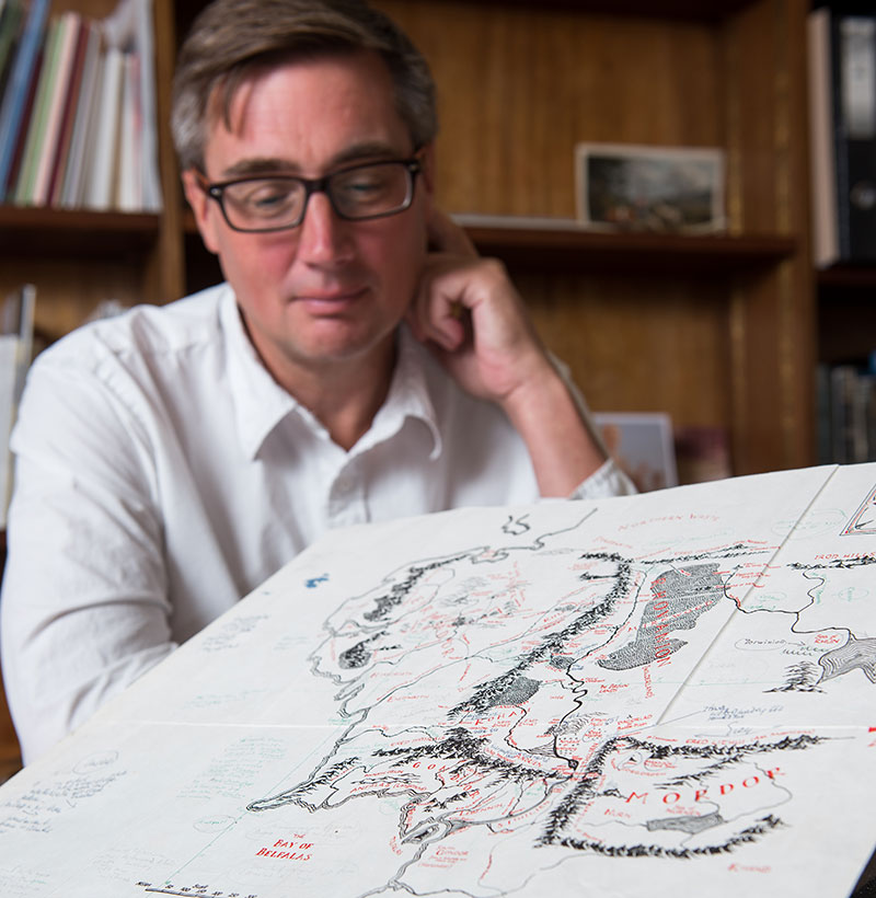
"The Bodleian Library has recently acquired a rare, annotated map of Middle-earth, the fantasy world setting for JRR Tolkien’s novels The Hobbit and The Lord of the Rings. The acquisition was made possible thanks to generous support from the V&A Purchase Grant Fund, the Kenneth Rose Fund and the Friends of the Bodleian."
https://www.campaign.ox.ac.uk/report2015-16/mapping-middle-earth

1 Dec, 2016
2016-12-1 10:23:35 AM UTC
Interesting - but there's a bit of a blooper here - it says
'Based on earlier designs by Tolkien’s son Christopher, the map was extracted from an edition of The Lord of the Rings in the late 1960s, and served as a working document – used by Tolkien and illustrator Pauline Baynes to develop a new poster depicting Middle-earth'
But of course this map isn't 'based on earlier designs by Christopher' - it was removed from Pauline Baynes's copy of TT; this (and the Mordor map in RK were actually drawn by Christopher (who signed 'em with initials), and it was he who'd tidied up his dad's maps for publication.

2 Dec, 2016
2016-12-2 2:01:48 AM UTC
Will they post a full-rez image of it for the people that cannot travel to Oxford?

2 Dec, 2016
2016-12-2 4:06:13 AM UTC
Morinehtar wrote:
Will they post a full-rez image of it for the people that cannot travel to Oxford?
I doubt it. I don't think the Estate would authorise it, even if they wanted to.

2 Dec, 2016
2016-12-2 6:21:38 AM UTC


 2475
2475 1.09M
1.09M